RAPID: Resilience Assessment for Communications right after Emergencies/Disasters (RACE)
Emmanuel Arzuaga emmanuel.arzuaga@upr.edu (Principal Investigator)
Sandra Cruz-Pol (Co-Principal Investigator)
Overview
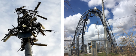
Telecommunications are a fundamental component of modern society. Handheld devices such as smartphones and tablets keep us connected and informed of day-to-day activities ranging from typical household issues, work, study and entertainment to emergency and disaster recovery. In the aftermath of the impact of hurricanes Irma and Maria on Puerto Rico, telecommunications were completely interrupted, disrupting most of the activities of the island’s population. A record number of the telecommunication infrastructure throughout the island was severely damaged and most towns remained uncommunicated for weeks. Several towns remained with zero communications for up to 8 months. The lack of telecommunications hardened the conditions of the entire population by disrupting logistics to even backup response and relief efforts.
In this one-year project, the Department of Electrical and Computer Engineering at the University of Puerto Rico at Mayagüez (UPRM) studied the state of the telecommunications infrastructure in Puerto Rico in the aftermath of hurricanes Irma and Maria. In particular, we studied how the Google Project Loon balloon-based telecommunication system prototype was effectively used as a backup telecommunication infrastructure alternative for emergency situations. We studied the effects of weather phenomena, atmospheric propagation, complex-terrain topography, altitude and lack of knowledge of users on how to configure technology as well as testing best ways to recognize radio signals from the balloons (Project Loon uses LTE channel 8 transmitting at around 900 MHz).
In addition, the current study aimed to determine the optimum way to setup personal mobile devices to detect and connect to LTE Band 8. Currently, this channel is not authorized for commercial use, but Google has obtained a temporary license to establish a Loon network to provide emergency communications for cellphones in Puerto Rico.
Educational and training activities
Introduction
In September 20, 2017 Hurricane Maria made landfall in Puerto Rico as Category 4 and caused severe damage to the island’s connectivity infrastructure. According to the Federal Communications Commission, of the 2,671 cell sites that serve the island, 2,437 of them were out after the hurricane, leaving 91.2% of the island uncommunicated. At the wakening of this problem, an emergency internet service such as Project Loon could be of immense help. FCC granted experimental license for Project Loon to operate in Band 8 around 900 MHz in Puerto Rico after hurricane Maria struck the island.
Project Loon is a network of balloons traveling on the edge of space (approximately 65,000 ft. altitude), designed to extend internet connectivity to people in rural and remote areas worldwide. The company aims to launch and maintain a fleet of balloons with autolaunchers capable of safely and consistently launching a new balloon every 30 minutes. High speed internet is transmitted up to the nearest balloon from a communications provider on the ground (such as AT&T and T-Mobile), relayed across the balloon network and then back down to users on the ground. In past experiments, they have demonstrated data transmission between balloons over 100 km apart and back down to people on the ground with connections speeds of up to 10 Mbps, directly to their LTE phones. All end users will connect via Loon to the existing network operators that partners with the project.
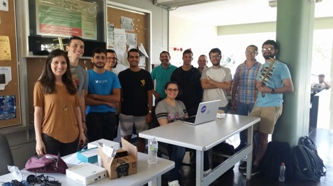
Field Campaigns
The first
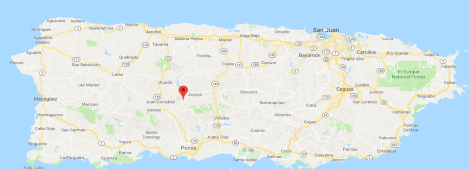
field campaign was performed on February 16, 2018 in the Central region of the island, which includes the towns of Ponce, Utuado, Jayuya, and Arecibo. The measurements were taken in the midst of slightly overcast weather, with a daily max recorded temperature of 80°F and a daily low of 71°F. Approximately, 0.08 inches of rain were reported this day. The time of the measurements spanned from 1:30 pm to 4:00 pm, approximately. Total time spent on field amounted to approximately 8 hours.
The second
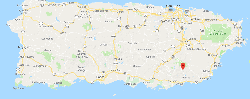
field campaign was performed on February 17, 2018 in the towns up to the east Patillas. The measurements were taken during clear, sunny weather, with a daily max recorded temperature of 86°F and a daily low of 77°F. According to a weather station in Guayama, 0 inches of rain were reported this day. The time of the measurements spanned from 11:00 am to 2:00 pm, approximately. Total time spent on field amounted to approximately 8 hours.
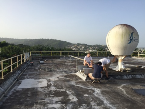
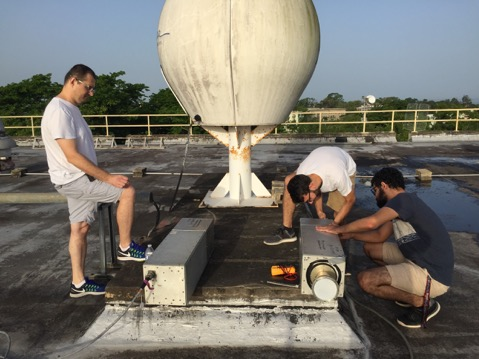
In order to perform additional calibrations of the signal measurement equipment under a variety of weather conditions, a final and third test was performed at 7:00 am on June 14, 2018 at the roof of the CID Building, UPRM campus (18.211347, -67.136864). The test was deliberately performed in this date due to the favorable conditions present at the time, which presented clear skies.
Meetings with Telephone Service Providers and Local Regulatory Agencies
Puerto Rico Telecommunications Regulatory Agency
In order to get a professional insight about the procedures, status, and difficulties of the deployment of telecommunications infrastructure in Puerto Rico in the event of a natural disaster, we spoke to Emanuel Nazario (IT Manager) and Sandra Torres (Director) of the Puerto Rico Telecommunications Regulatory Agency (Junta Regulatoria de Telecomunicaciones / JRT).
They provided insights about the difficulties faced in restoring communications and basic services to people on the island. They elaborated on the shortcomings regarding telecommunication satellites (Iridium), which were unsuccessful due to sky conditions on the island. Several logistics and legal shortcomings were also present during the aftermath of Hurricane Maria, such as the transportation and unloading of valuable reconstruction supplies that were needed for restoring infrastructure, such as power poles, wires, and airspace operation licenses for the Google Loon project.
Finally, they commented on the difficulties faced due to lack of effective effort coordination with the Puerto Rico Electric Company, who damaged infrastructure in the process of cutting down tree branches interfering with public wiring, and subsequently stolen copper wires.
AT&T
In order to get a professional insight about the procedures, status, and difficulties of the deployment of telecommunications infrastructure in Puerto Rico in the event of a natural disaster, we spoke to Victor Vera and Carlos Aviles, from the Radio Access Network Division at AT&T Mobility.
From their experience within the organization, and with access to all the relevant information about the deployment and status of infrastructure such as:
- Location and status of cellular communication towers.
- Status of priority civilian infrastructure, such as hospitals.
- Closed/blocked road events.
- Location of infrastructure repair orders and.
- Location and usage statistics of COWS (Cells On WheelS/WingS) devices.
They were able to provide some insights about the status of infrastructure in the wake of a natural disaster event. In such an event, they mentioned that the most resilient technologies after Hurricane Maria were those most often forgotten: Landline wires and amateur (Ham) radio devices. On the other hand, mass television and radio stations at the time of Hurricane Maria were unable to remain in operation due to destruction of antennas, and lack of sufficient energy for continuously operating their high-power electrical hardware. For the specific case of satellite communications, they mentioned these did not perform as expected, which coincides with anecdotal accounts from users with access to satellite phones.
Finally, they mentioned it is of utmost importance to coordinate telecommunication restoration efforts with those of electrical grid restoration, as a common issue was that power was restored to communities, but cellular towers remained on auxiliary power generators, which resulted in unreliable operation.
Computational Modeling
In order to validate the results obtained during the Field Campaigns described in Section 3, and rule out any measurement error on our part, we developed a signal propagation signal model. The model was developed following the corresponding ITU recommendations for free space path loss, and attenuation levels introduced by atmospheric gases, rain and fog conditions. The model was developed in Python, and we made use of the available ITU-Rpy package, which directly implements the signal propagation equations given by the ITU recommendations. The used ITU-Rpy modules used for our study were the itu838 (rain attenuation, ITU-R P.838), itu840 (cloud and fog attenuation, ITU-R P.840) and itu876 (atmospheric gas attenuation, ITU-R P.838). Calculation of Free Space Path Loss due to propagation distance is performed by a custom solutioned developed by us. Our code for the signal propagation model is publicly available in https://github.com/josue-castro/loons.
Conclusions and Recommendations
After several meetings with the director of the Puerto Rico Telecommunications Board and with head of local AT&T, the most effective communication platforms were determined to be:
- Landline telephones
- Amateur (ham) radio devices
- Satellite Phones
- Cellphones (through the use of deployed COWS stations)
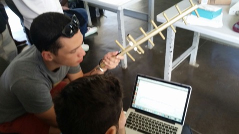
On the subject of Project Loon – We used several smartphone models running different operating systems such as iOS (iPhone 6, 6s) and Android (Samsung Galaxy S6, S7, Motorola Moto X, LG Stylo 3 Plus) to evaluate the effectiveness of connecting to such signal. Signal quality was measured using the SignalCheckPro application:
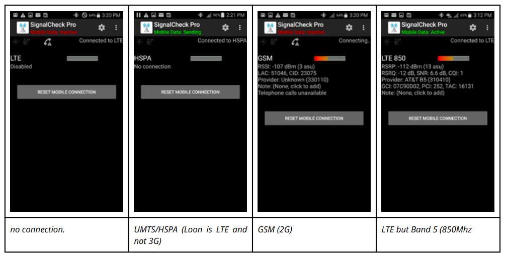
According to personal communications on Feb 22, 2018, with Google Project Loon Leader, Salvador Candido, and their lead team: “The first screenshot has no connection. – The second one is UMTS/HSPA (Loon is LTE and not 3G) – The third one is GSM (2G) – The fourth one is LTE but Band 5 (850Mhz) None of these are Loon. His feedback is that you’re not doing anything wrong but testing in places where the signal from a terrestrial network is present / stronger than the signal from Loon. That tends to be the case any time you are near an operational terrestrial tower. That seems to correspond to what AT&T says about a lot of the terrestrial being back up.“
Our computational experiments using signal propagation models indicate that the current iteration of the balloon-based system for cellular communications is unable to reliably establish a communication network with personal devices on the ground. This is further corroborated by our field expeditions described above, which were not able not able to measure signal power levels in accordance to the ranges required by cellular communication devices.
In order to improve the viability of this project, we consider it is necessary to conduct additional research and developing further system design refinements. In the meantime, it is recommended to continue the work on public information dissemination campaigns related to the use of alternative communication methods in case of emergency events, such as the use of satellite phones and the identification of local Ham radio infrastructure.
With the objective of improving viability of the system as a deployable, temporary emergency communication infrastructure, we suggest the introduction of specialized reception equipment in the form of ground stations, which are able to operate on signal levels in accordance to the ones received after attenuation resulting from propagating through the entirety of the troposphere.
A supplementary proposal to the Foundation: Unidos Por Puerto Rico (United for Puerto Rico), submitted by Dr. Cruz-Pol to train people into the acquisition of their personal ham radio licenses help us to better understand the viability of such technology in emergency situations. The proposal was titled URPM Emergency Communication project (UPRM ECOMM). With these funds, we help to host ten 8-hour Saturday classes at the UPRM campus. Attendance included over 100 participants from diverse backgrounds such as the healthcare sector, pharmaceutical sector, churches and community leaders. Attendants received lessons, lectures, and a review of the various aspects of ham radio operation.
A final exam was administered on February 2019. The exam results reflected that 40 candidates passed, and 10 did not pass. In addition, there was 1 re-test, and 1 General element no pass. These results include a blind candidate that successfully completed his Technician ham radio license.
The co-director of the project is Victor Huerfano, who is also the director of the Puerto Rico Seismic Network at UPRM, and now a new Ham Radio operator enhancing resilient capabilities on communications in case of a Tsunami, Earthquake or Hurricane.